| Click Map to Enlarge | Name / Content of Map |
|
|
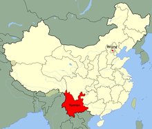
Yunnan in ChinaThis map shows where in China Yunnan is located. It covers parts of China's southwest and borders Tibet, Sichuan, Guizhou and Guangxi. Yunnan also shares international borders with Vietnam, Laos and Myanmar to the south and west. |
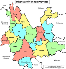 |
Districts of Yunnan ProvinceThis map shows all 16 districts - or prefectures - of Yunnan Province. |
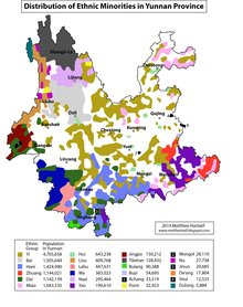 |
Distribution of Ethnic Minorities in Yunnan ProvinceThis map provides an overview of the numerous ethnic minorities throughout Yunnan including their population (status 2014). |
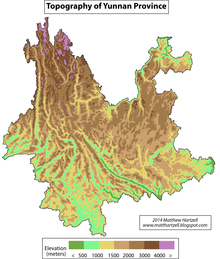 |
Topography of Yunnan ProvinceThis map shows Yunnan's topography. While in Yunnan's north mountains rise up to 6740m, the south is mainly characterized by subtropical lowlands around the Honghe and Mekong River in Xishuangbanna. |
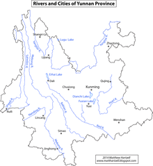 |
Rivers and Cities of Yunnan ProvinceMajor and popular streams make their way from Tibet through Yunnan before flowing through other countries and into the ocean. The protected UNESCO World Heritage site 'Three Parallel Rivers' is formed by the Yangtze River, the Mekong River (or Lancang River) and the Salween River. |
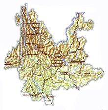 |
Yunnan Province Roads & SightsThis map provides an overview of the major road sistem as well as the location of some important sights in Yunnan. |
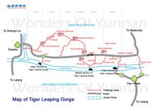 |
Map of Tiger Leaping GorgeThe Tiger Leaping Gorge is located between Lijiang and Shangri-La in Yunnan's north. This map shows the hiking paths with accommodation facilities as well as roads. |
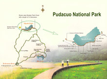 |
Pudacuo National Park, Shangri-LaThe Pudacuo National Park is located just north of Shangri-La. This map shows the walking area at the lakes and the road network around. |
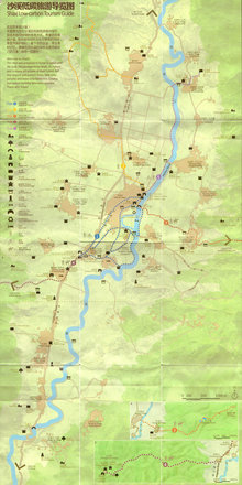 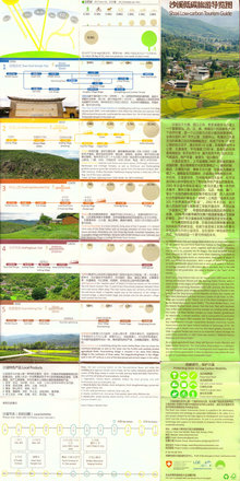 |
Shaxi Hiking MapShaxi Old Town and its surrounding villages is located between Dali and Lijiang. This map includes hiking paths as well as distances and an interesting carbon usage comparison. |
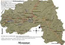 |
Xishuangbanna Roads & SightsThe most southern, lowest and hottest prefecture of Yunnan is Xishuangbanna. This map shows the district's roads and sights. Get more details on this area and related tours here. |
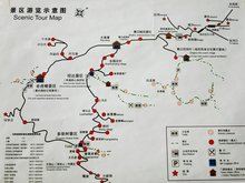 |
Yuanyang Scenic AreaThe Scenic area in Yuanyang comprises the most spectacular rice fields of the Hani Minority.This road map also includes the best spots for sunrise and sunset photography. For further information and related tours to Yuanyang, please click here. |
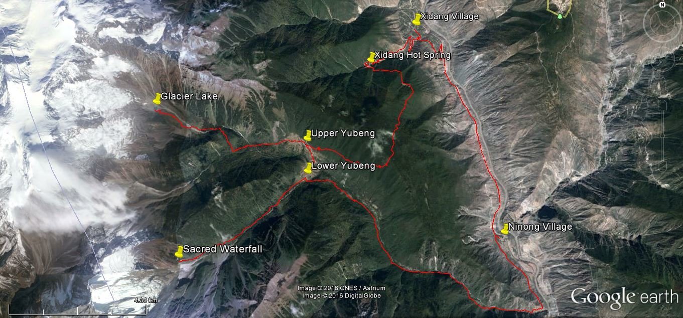 |
Yubeng Hiking MapYubeng is located about 200 km north of Shangri-La in Yunnan's part of the Himalyas between the Mekong River to the east and the Nujiang Valley to the west. This map shows a possible hiking route within the Meili Snow Mountain National Park to Yubeng, taking 4-5 days. For further information on this trek, please click here. |
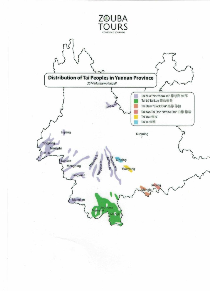 |
Distribution of Tai Peoples in Yunnan Province |
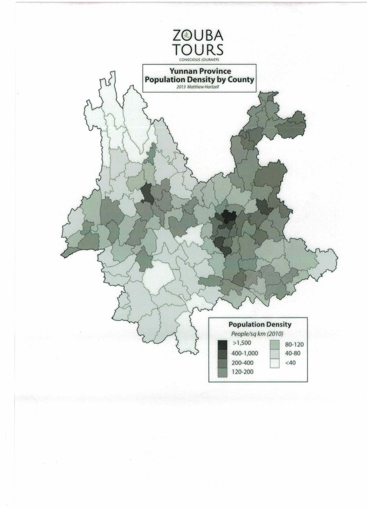 |
Yunnan Province Population Density by County |
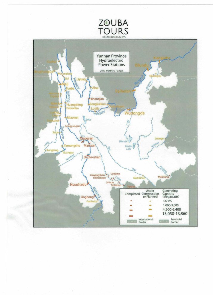 |
Yunnan Province Hydroelectric Power Stations |
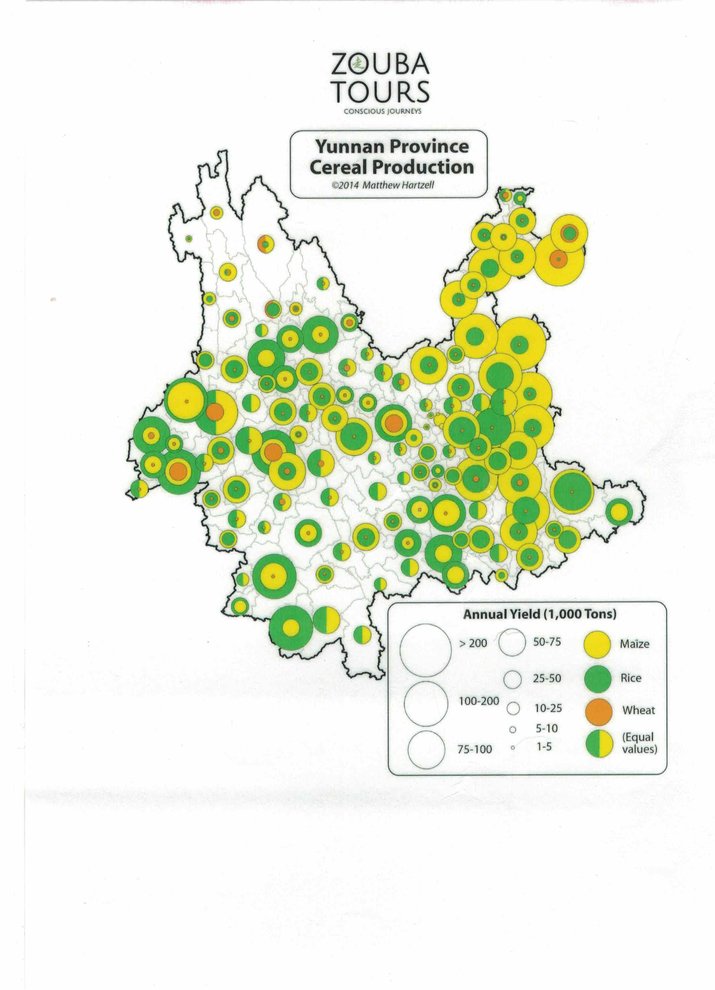 |
Yunnan Province Cereal Production |
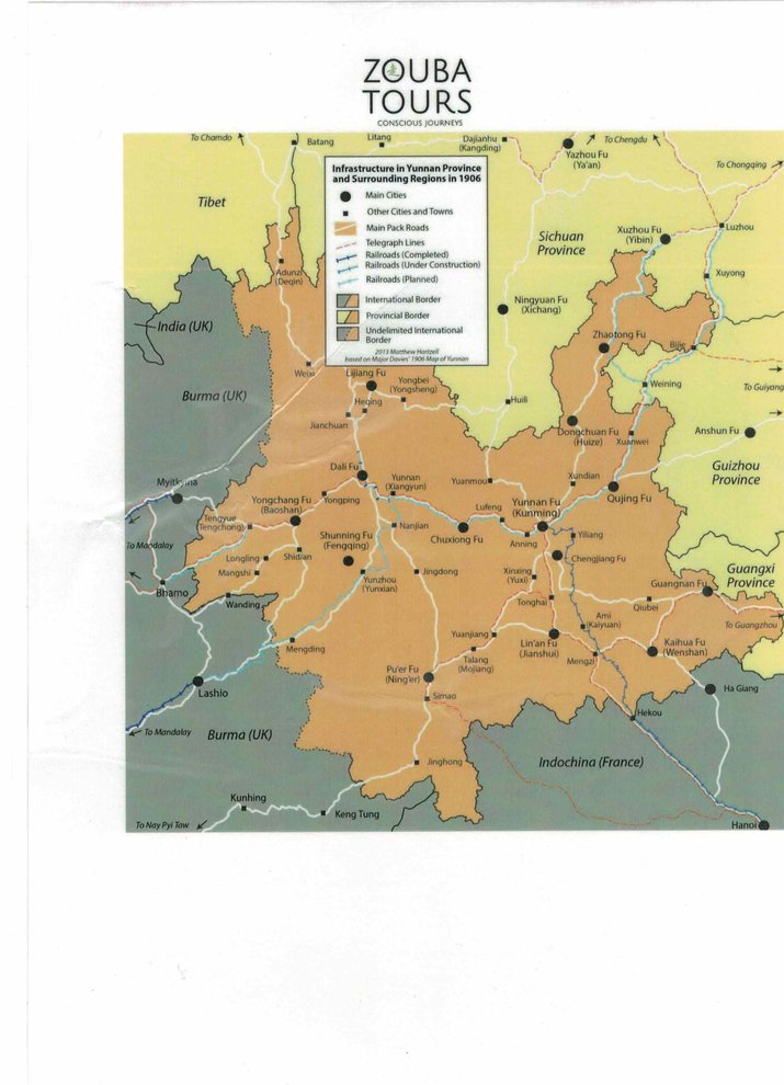 |
Infrastructure in Yunnan Province and Surrounding Regions in 1906 |
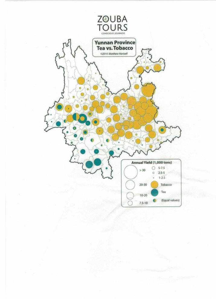 |
Yunnan Province Tea vs.Tobacco |
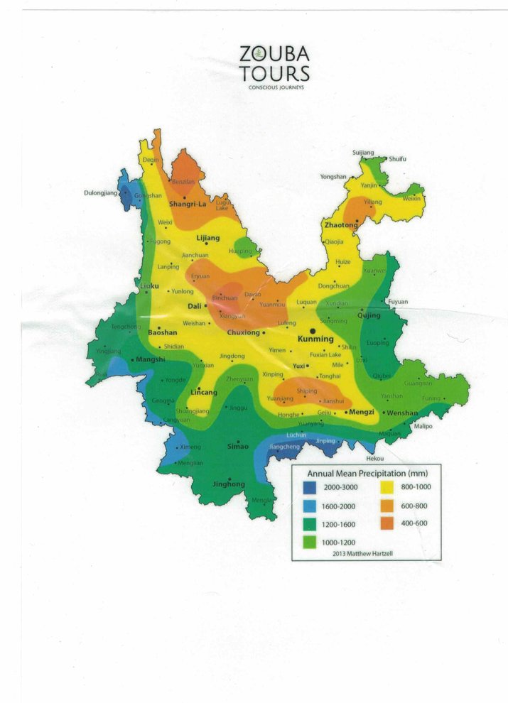 |
Annual Mean Precipitation(mm)in Yunnan |
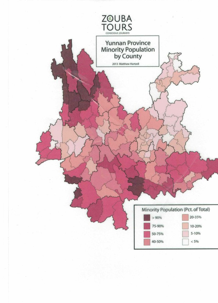 |
Yunnan Province Minority Population by County |
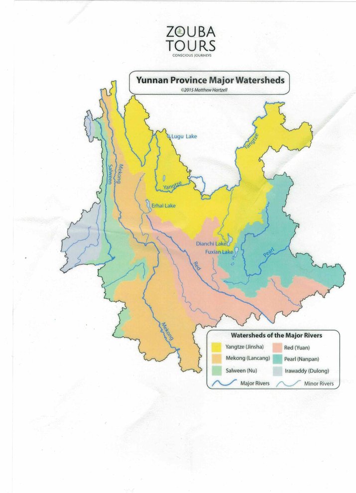 |
Yunnan Province Major Watersheds |
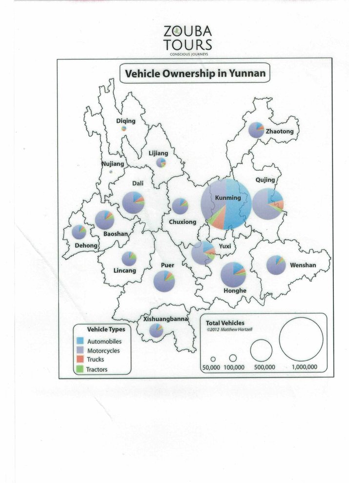 |
Vehicle Ownership in Yunnan |
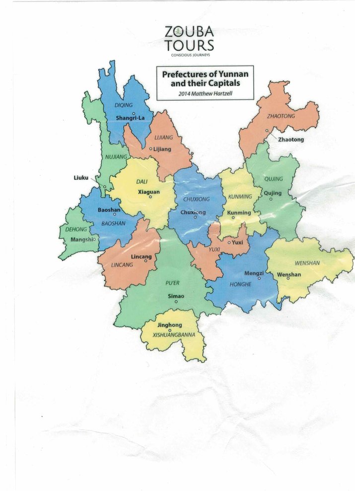 |
Prefectures of Yunnan and their Capitals |
- 14364 reads

